Leiden University: Archaeological Heritage Value Mapping in Trinidad and Tobago
Trinidad and Tobago, a twin-island nation, has over 300 identified archaeological sites that testify to its diverse history, covering pre-colonial, colonial, and post-colonial periods. Many of these sites were discovered by archaeologists in the 20th century and have not been regularly visited and assessed. The absence of regular assessments poses significant risks to preserving and understanding these sites. Now the National Trust of Trinidad and Tobago and the Leiden Faculty of Archaeology join forces to map and preserve the archaeological sites on the islands.
Unique threats
In the Caribbean, natural disasters and rapid urbanization present a unique threat to archaeological sites. Often, these sites can be unassuming, making them nearly invisible to those without specialized training. As a result, invaluable pieces of history risk being inadvertently destroyed or built over, erasing links to the past that can never be reclaimed. Consistent site assessments and community awareness cannot be overstated in safeguarding these irreplaceable archaeological assets.
In response to the pressing challenges of preserving these invaluable sites amidst urban development, the National Trust of Trinidad and Tobago (NTTT) in collaboration with the Faculty of Archaeology at Leiden University and the CaribTrails project at KITLV conducted the field exercise “Archaeological Heritage Value Mapping in Trinidad,” conceived with a dual purpose of contributing significantly to the broader objectives of addressing archaeological heritage management in Trinidad and Tobago. At the same time providing students in archaeology and history with invaluable practical experience in archaeological fieldwork.

Diverse landscape
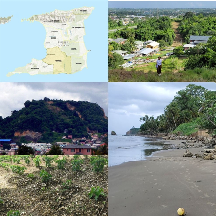
Victoria County, with its diverse landscape ranging from bustling urban hubs to serene rural villages, was the chosen epi-centre for this first field season. This decision was influenced by its status as the region with the most identified Archaeological Heritage Sites and the availability of the most recent and pertinent data from 2003.
The team, under the guidance of Ashleigh John Morris, Heritage Preservation and Research Officer at the NTTT and PhD Candidate at the Faculty of Archaeology, Leiden University, consisted of BA students in archaeology from Leiden and a BA student in history from the University of the West Indies. Together the team embarked on this ambitious project to locate and critically evaluate the geographical and cultural contexts of archaeological sites in Victoria County.

Identifying site locations
Before the start of the field project, all available documentary and archival data, including site inventories and sketch maps, were scrutinized to identify site locations. Geospatial data collection was employed to revise existing data on site location, distribution, and scope. Conservation status assessments were undertaken to validate or update existing data, and photographic documentation was accumulated. Most importantly, community engagement was at the forefront, facilitating dialogues and knowledge exchange with local residents. Also, relatively accessible data capture methods were used with cellphone applications to enable community members in future monitoring exercises. Open-source GIS software and cellphone applications were used while relying on traditional techniques such as field walking and survey photography.
Challenges and achievements
The project, while ambitious, faced its share of challenges. Accessibility issues arose with many sites located on private lands. Seasonal factors like the rainy season and its accompanying dense vegetation obscured some sites. Outdated GPS data posed additional challenges in site identification. Time constraints also meant that not all locations of interest could be explored.
Nevertheless, the team’s dedication was evident in their achievements. They successfully identified accurate GPS coordinates for several sites, accomplishing 50% of the surveys they had initially aimed for. In summary, while the “Archaeological Heritage Value Mapping in Trinidad” project is in its nascent stages, its contributions thus far are noteworthy. The knowledge and insights derived from this initiative are poised to inform and shape future policies and strategies. It is the fervent hope of all involved that this project marks the beginning of numerous surveying exercises to visit and assess every known archaeological site in Trinidad and Tobago and identify unrecorded ones. Through such endeavours, we can ensure that the nation’s archaeological sites are safeguarded and appreciated for future generations, especially when researchers and communities collaborate harmoniously.

