Cloud parameters using a ground- based airglow imager indicate large shift in monsoon rainfall pattern
Estimation of cloud speed and wind pattern over Kolhapur in Maharashtra, during the months of March to May, from the year 2016 to 2020 have revealed a change in pre-monsoon cloud fraction and direction of its propagation indicating a large shift in monsoon rainfall pattern.
It is known that clouds can scatter the incoming solar radiation in the atmosphere and act as a blanket to the earth’s outgoing long-wave radiation. Clouds have significant impact on the Earth’s climate which by direct and indirect processes is non-linear in its nature. The effect is modulated by the space-time distribution and their height, thickness, size distribution and so on. Satellite sensors detect the cloud motion and under the assumption that clouds move with winds, and derive the Cloud Motion Vector, ‘CMV’. Values of CMV are very useful in understanding the synoptic scale atmospheric dynamics and circulations.
Scientists of Indian Institute of Geomagnetism (IIG), an autonomous institute of Department of Science and Technology employed all sky imager data (ASI), (usually utilised for upper atmospheric studies) for cloud tracing in the low latitude station Kolhapur (16.8° N, 74.2° E). Generally, the all sky imager is used to observe night airglow, however the scientists used it to trace the cloud. They used cloudy data of the night time for this research. The utilisation of waste data or cloudy sky data which is considered irrelevant for airglow study, for this investigation is a novel feature of this work.
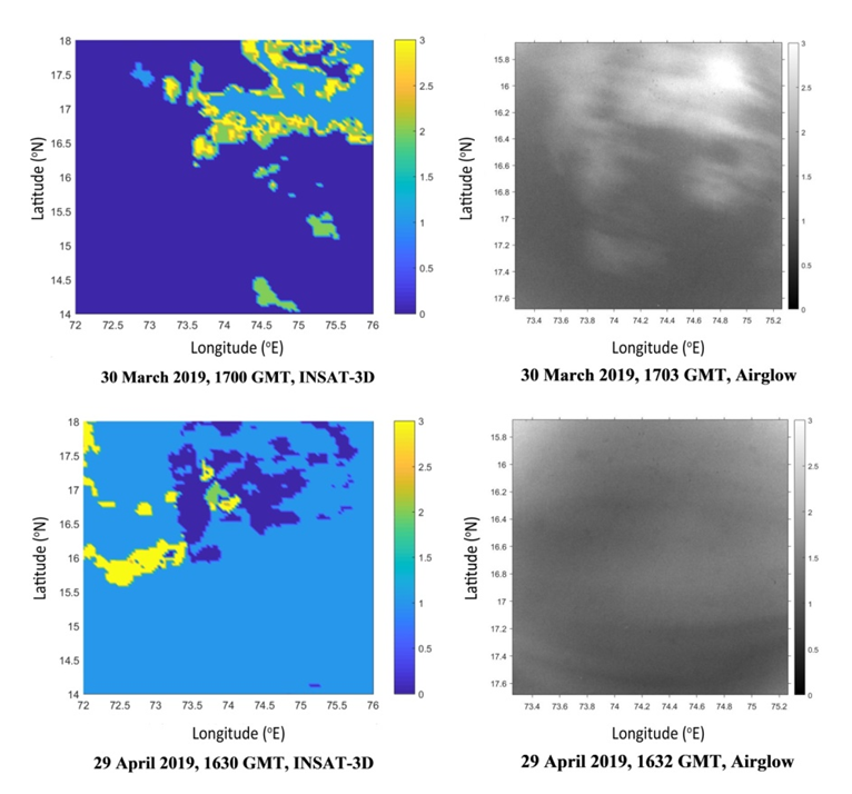
ASI has very high spatial resolution and this helped the scientists compare the data with INSAT data of 10 km resolution. Using the data collected over the period of 2016 to 2020 during March, April and May months of airglow monitoring, the researchers calculated the cloud motion vector, cloud coverage percentage and direction of cloud movement. The slowest speed of 10±3 m s–1 was observed in the 2017, while in other years it was over 15±3 m s–1. The clouds were found to move in a south-westerly direction during the time period under consideration.
The Kolhapur location being closer to the Arabian Sea, the winds as well as the cloud motion noted in our data were observed in the South-West direction. It is important to note that the direction of the cloud propagation is turning in the Southward direction as the year progresses. This is more evident in the March and April month data. This may have a linkage to large climatic changes. Using this analysis, the researchers showed that there is a shift occurring in the monsoon pattern, which may be imprinted in the rainfall behavior as well.

Figure 1. Sample comparison between INSAT 3-D data and ground based airglow imager data. Color bar shows the intensity variation in INSAT-3D and airglow image

